Caring for Our Coastal Waterways
These are the bays, rivers, and streams we’re working to protect and preserve so that local wildlife, people, and industry can thrive. Explore this interactive map and read on to learn more about the five watersheds that make up our beautiful Tillamook Coast.
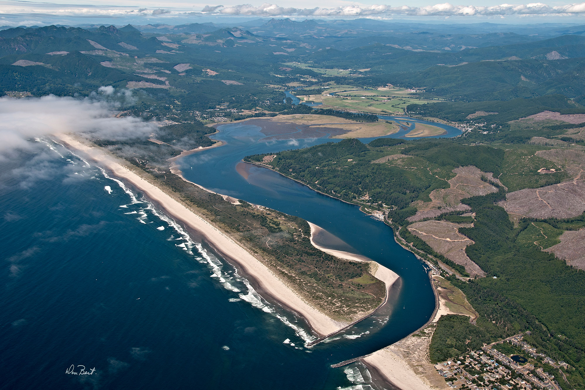
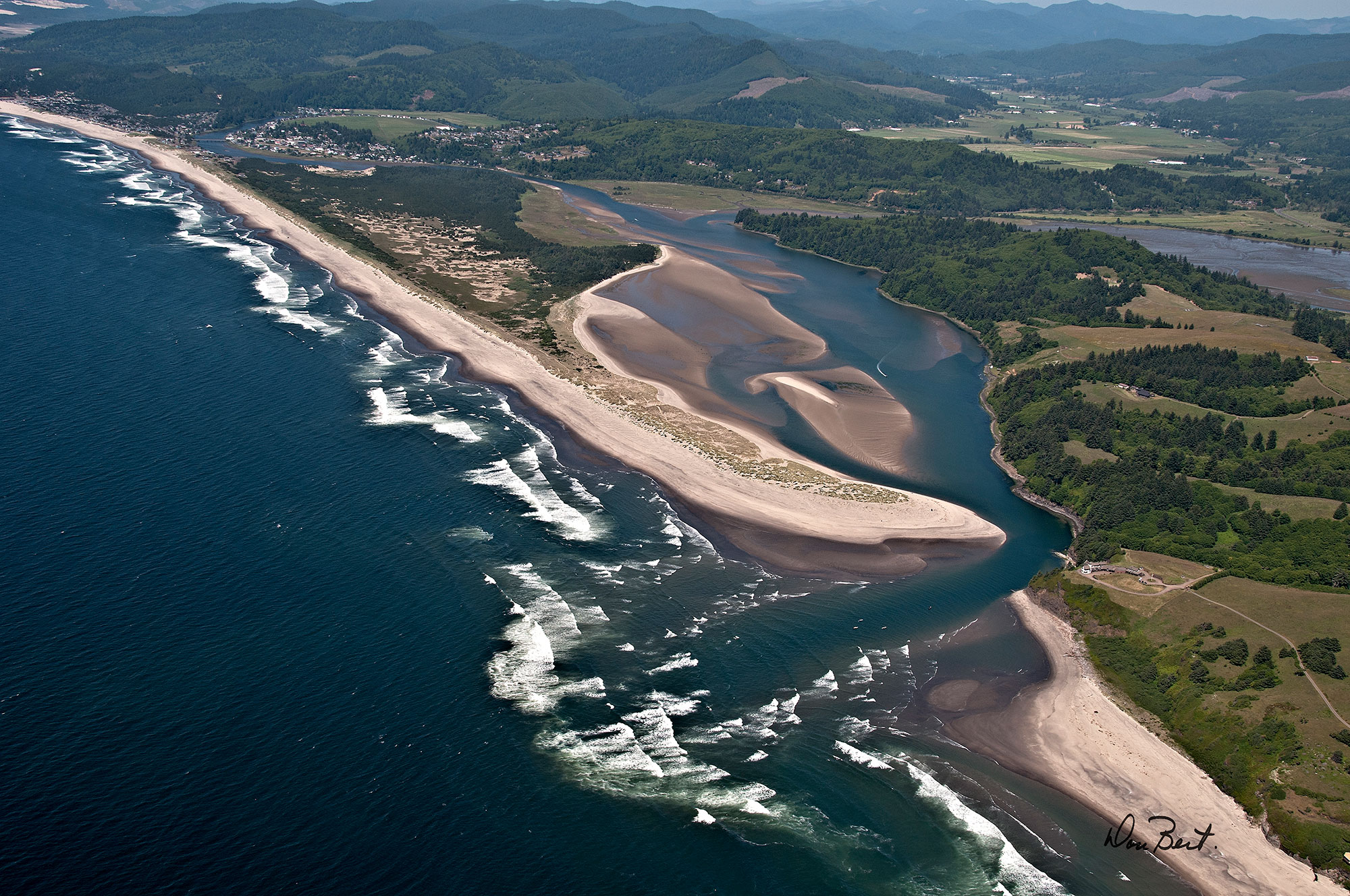
Nehalem River Watershed
The Nehalem River stretches for 118 miles and is Oregon’s largest stream contained entirely within the coast range. Along its journey, the Nehalem River flows through dense forests, then quietly meanders by green pastures, small towns and basalt canyons before entering Nehalem Bay. Around the turn of the 20th century, the margins of the bay were abuzz with a bustling community of several thousand residents centered on agricultural products, logging, and a plentiful salmon fishery.
Today, the area has a quieter appeal, while still maintaining its charm of old. Tourism is an increasing focus of the local communities, as evidenced by the expansive Nehalem Bay State Park. Work to restore and conserve ecological functions throughout the watershed is buoyed by the active efforts of partners in the upper Nehalem River, lower Nehalem River, and Nehalem Bay.
Facts
Size
855 square miles
TEP focus Area
46%
Estuary Geomorphology
Drowned River Mouth
Photo by
Don Best
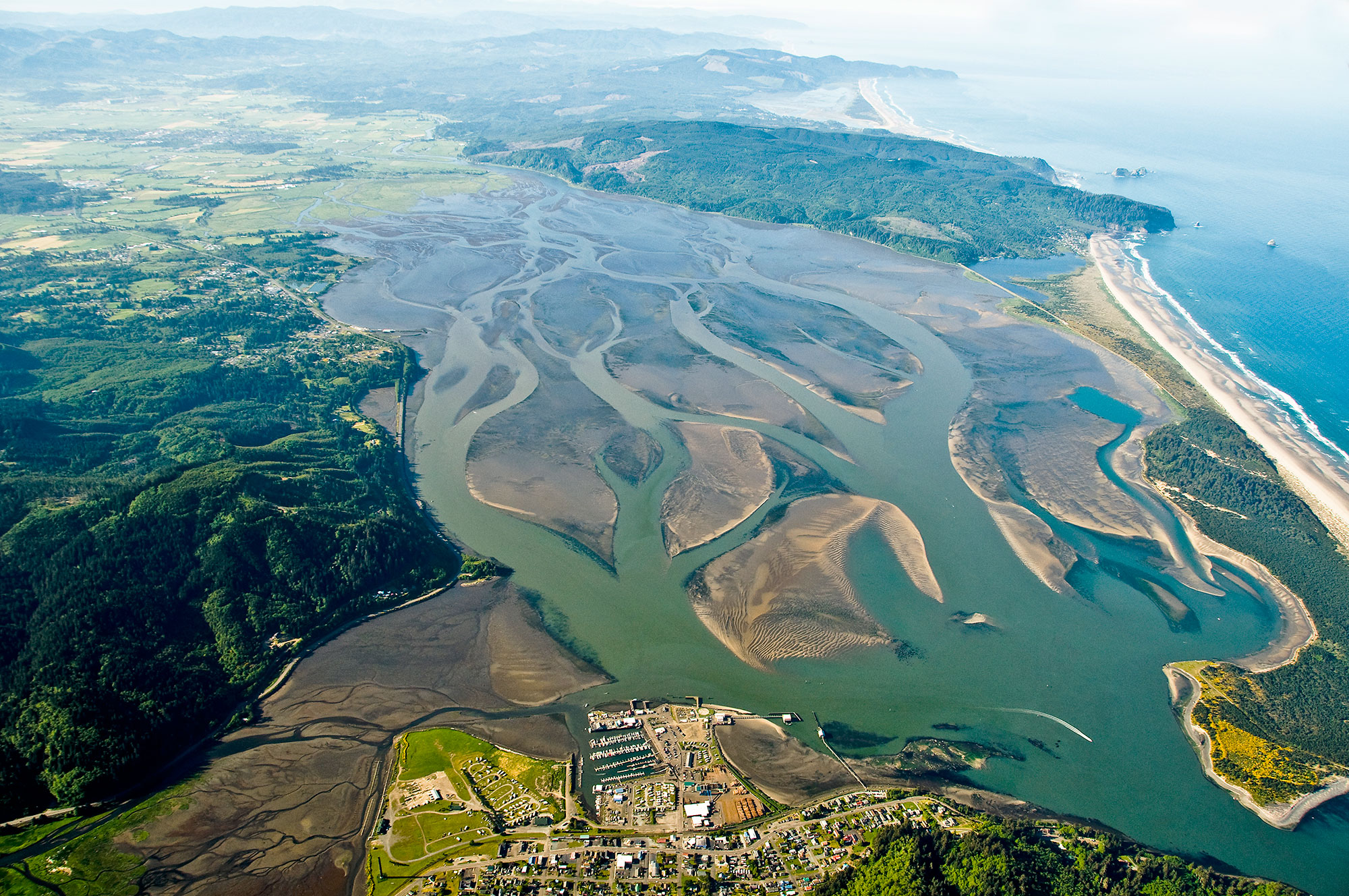
Tillamook Bay Watershed
Tillamook Bay is Oregon’s second largest bay, and one of its most prized resources. The bay supports a thriving oyster industry and some of the best runs of salmon and steelhead on the West Coast. In addition, broad fertile floodplains play host to rich dairy lands which produce world-class cheese. A healthy and functioning Tillamook Bay is essential to not only honor our cultural landscape and crucial natural resources, but to the overall vitality of its surrounding communities. TEP, along with many partners, are dedicated to further understanding the mechanisms at work and finding practical solutions to ensure the long-term sustainability of this “Bay of National Significance.”
Facts
Size
583 square miles
TEP focus Area
31%
Estuary Geomorphology
Drowned River Mouth
Photo by
Don Best
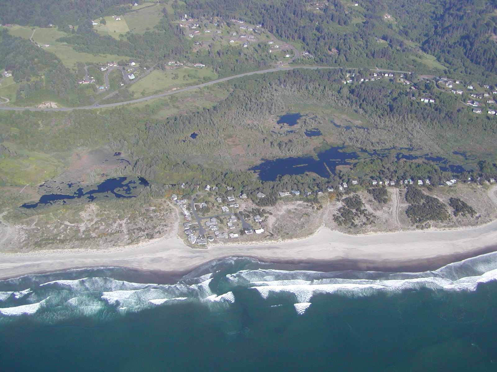
Netarts Bay Watershed
Netarts Bay (along with Sand Lake) boasts a predominately pristine estuarine environment compared to its sister bays in Tillamook County. This is due to the relatively light influence of development along its shores and throughout its watershed. Rather than being fed by larger rivers, Netarts Bay is fed by 16 smaller direct-to-bay creeks. The bay is approximately 2,325 acres, 812 acres of which are permanently submerged. Despite its size, Netarts Bay is a highly dynamic system that influences coastal erosion throughout its littoral cell. In addition to the many recreational opportunities, Netarts is home to robust commercial oyster operations and an emerging premium sea salt industry. Netarts Bay is a pilot site for a project focused on restoring the Pacific Northwest’s native Olympia Oyster within its historical distribution. Because of Netarts relatively unaltered natural state, it is often used as a reference site to compare the water and habitat quality of other estuaries.
Facts
Size
26 square miles
TEP focus Area
1%
Estuary Geomorphology
Bar-built Estuary
Photo by
Don Best
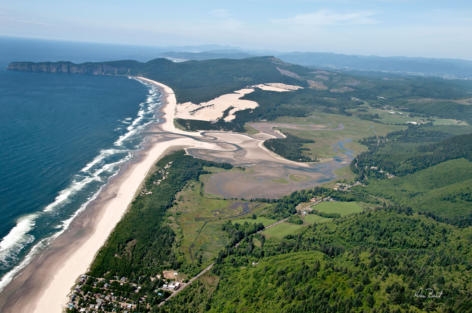
Sand Lake Watershed
The Sand Lake Estuary is a beautiful, relatively untouched estuarine ecosystem. It is only one of five estuaries on the Oregon Coast designated as a “natural estuary.” There is minimal freshwater influence within the estuary from the watershed, as such it is dominated by tidal influence. Much of the land encompassed by the estuary is estuarine marsh which is exposed by tides daily. Because of this, Sand Lake is home to many unique tidal wetland plant species. Thousands of visitors each year enjoy the adjacent Sand Lake Recreation area, the Clay Myers State Natural Area, and one of Oregon State Parks newest acquisition’s, the Sitka Sedge State Natural Area on Sand Lake spit.
Facts
Size
25 square miles
TEP focus Area
1%
Estuary Geomorphology
Bar-built Estuary
Photo by
Don Best
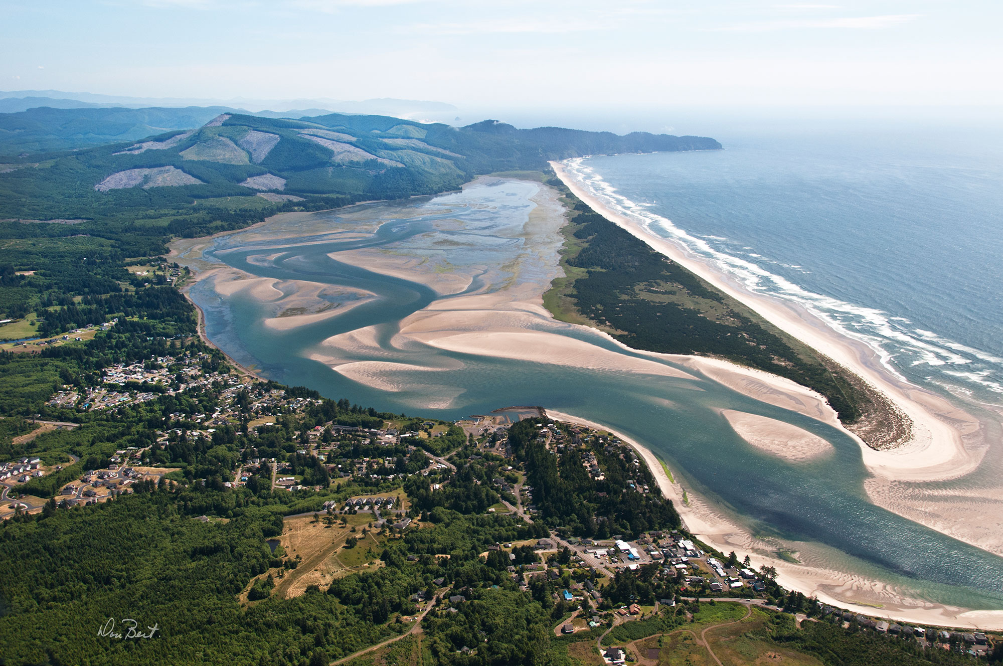
Nestucca Bay Watershed
Seasonally, a variably-sized sand bar (spit) forms from the interaction of currents from the ocean and freshwater rivers and separates the bay and the ocean. Part of the bay is contained within the Nestucca Bay National Wildlife Refuge. Like many of the estuaries in Tillamook County, Nestucca Bay is a valuable natural resource supporting an economy dependent on fishing, forestry, tourism, and agriculture. The fishing culture of the Nestucca is highlighted by the century-old beach-launched dory fishery at Cape Kiwanda. Partners in the watershed are working diligently to improve water quality, fish passage, and salmonid habitat in the watershed and bay.
Facts
Size
319 square miles
TEP focus Area
17%
Estuary Geomorphology
Drowned River Mouth
Photo by
Don Best
Neskowin Creek Watershed
Located at the confluence of Neskowin and Hawk Creeks in the heart of Neskowin, the estuary offers a brief transition between fresh and saltwater ecosystems. Twice a day saltwater encroaches up the creeks on incoming tides providing saltmarsh, mudflat, and estuarine forest habitats. The estuary is fed by the Kiwanda and Neskowin Creeks. The creeks and their accompanying tributaries wind through national forest land, commercial logging property, and various other private entities.
The Neskowin Creek estuary is classified as a minor conservation estuary under the Oregon Estuary Classification system. The mouth of the estuary has no maintained jetties or channels and provides no passage for boats. Most of the estuary lies adjacent to urban areas with developed shorelines. The estuary is also influenced by a tide gate on Butte Creek, approximately two (2) miles above the junction with Hawk Creek.
Facts
Size
26 square miles
TEP focus Area
17%
Estuary Geomorphology
Drowned River Mouth
Photo by
Don Best